
Measuring land and calculating areas is no longer a task exclusive to engineers or surveyors with sophisticated equipment. Today, anyone can take measurements safely and accurately directly from their cell phone. Whether for professional use, construction planning, or even rural activities, there are apps that use GPS, interactive maps, and smart tools to offer a practical and efficient solution. And the best part: you can download them right below.
Next, discover five safe, intuitive, and reliable apps for measuring land and areas directly from your smartphone.
1. GPS Fields Area Measure
THE GPS Fields Area Measure It is one of the most popular applications when it comes to land measurement. With a user-friendly interface and support for various types of users — from farmers to engineers — it offers precise measurements based on the device's GPS.

Area and Distance Meter
Its main feature is the ability to mark points on the map, which can be done manually or based on the user's current location. This allows users to define the desired area by walking along the perimeter or drawing directly on the map. It also allows visualization of the total area in square meters, hectares, or other units.
Another advantage is the ability to save and name each measurement, as well as share the areas via email or other apps. For those who need organization and record-keeping, this feature is extremely useful. The free version is quite complete, but there are also advanced options for professional users.
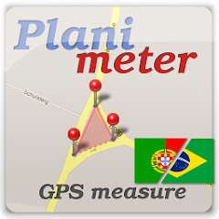
2. Planimeter – GPS Area Measure
Simple, yet powerful, the Planimeter It is designed for those seeking precision and practicality. It stands out for its high level of detail in measurements and for being ideal for both urban and rural environments.
Planimeter: measuring area on a map
The app allows you to measure land area and perimeter with just a few taps on the screen, directly on the satellite map. It's also possible to import GPS coordinates, which simplifies its use in technical projects. Navigation is smooth, and results are provided quickly.
Planimeter also includes useful features such as data export, support for multiple units of measurement, advanced zoom, and the ability to add annotations to measured areas. Its reliability and stability make it an excellent choice for professionals working in real estate, agriculture, or surveying.
3. Measure Map
THE Measure Map It is an application widely used by architects, urban planners, and engineers. Its focus is on the precise and rapid measurement of areas and perimeters, offering a refined and functional interface.

Application
The main tool consists of drawing or marking points on high-resolution maps to define the desired area. The app automatically calculates the total area and perimeter, offering support for saving projects and exporting data in formats such as KML, CSV, or PDF.
Among Measure Map's highlights are its precision, which is adjustable according to the zoom level, and its efficient technical support. It also has a Pro version, aimed at more demanding users, with advanced features such as multiple layers and a complete measurement history.
4. Geo Measure Area Calculator
THE Geo Measure Area Calculator It's ideal for those who want to measure land quickly and easily without sacrificing reliability. Highly intuitive, it allows you to plot areas directly on the map or based on your current location via GPS.

Geo Measurement Calculator Area
Simply add the marker points, and the app will automatically calculate the area and perimeter. The units of measurement are configurable, and the results can be shared via email or messaging apps.
In addition, the app has features such as real-time viewing, satellite mode, and tools for precisely adjusting points. Its performance is excellent even on simpler devices, making it accessible to a wider audience—from students to professionals in the field.
5. Land Area Calculator – GPS
THE Land Area Calculator It is another reliable and widely used application for accurately measuring land. It combines usability with practical features, making it a great tool for both personal and professional use.

GPS land area calculator
You can measure areas manually by drawing on the map or by using GPS to record actual points on the terrain. The app automatically calculates the area and perimeter and allows you to choose between various units of measurement, such as square meters, hectares, and acres.
One of the distinguishing features of the Land Area Calculator is the ability to measure multiple areas within the same project, which is useful for those who work with land divisions or farms. It also offers export in different formats and automatic saving of projects.
These five apps demonstrate how technology can make it easier for those who need to measure land and calculate areas safely. With integrated GPS tools, detailed maps, and user-friendly interfaces, they all offer practical solutions that fit in your pocket — literally. Choose the one that best suits your needs and start measuring accurately right from your cell phone.